চিত্র:1997 Red River Flood Grand Forks.jpg

এই প্রাকদর্শনের আকার: ২২০ × ১৭৪ পিক্সেল। অন্যান্য আকারসমূহ: ৩০৩ × ২৪০ পিক্সেল | ১,৫০০ × ১,১৮৮ পিক্সেল।
মূল ফাইল (১,৫০০ × ১,১৮৮ পিক্সেল, ফাইলের আকার: ৮১২ কিলোবাইট, এমআইএমই ধরন: image/jpeg)
| বিবরণ1997 Red River Flood Grand Forks.jpg |
English: The Red River in flood in April or May 1997 in Grand Forks, North Dakota and East Grand Forks, Minnesota. |
||||
| তারিখ | |||||
| উৎস |
U.S. Army Corps of Engineers Digital Visual Library Image page Image description page Digital Visual Library home page |
||||
| লেখক | Ken Gardner, U.S. Army Corps of Engineers | ||||
| অনুমতি (এ ফাইলের পুনঃব্যবহার) |
|
||||
| অবস্থান InfoField | Grand Forks, North Dakota and East Grand Forks, Minnesota, USA |


| ক্যামেরার অবস্থান |  | এটি এবং অন্যান্য ছবি তাদের অবস্থানের উপর: ওপেনস্ট্রিটম্যাপ |  47.926953; -97.028472 47.926953; -97.028472 |
|---|

ক্যাপশন
এই ফাইলটি কী উপস্থাপন করছে তার এক লাইন ব্যাখ্যা যোগ করুন
Digues construites dans le lit majeur, et le lit mineur marqué par les alignements d'arbres de la berge (Red River, inondation du printemps 1997, Minnesota, USA). Ces endiguements déplacent et aggravent l'inondation plus qu'ils ne la traitent.
ফাইলের ইতিহাস
যেকোনো তারিখ/সময়ে ক্লিক করে দেখুন ফাইলটি তখন কী অবস্থায় ছিল।
| তারিখ/সময় | সংক্ষেপচিত্র | মাত্রা | ব্যবহারকারী | মন্তব্য | |
|---|---|---|---|---|---|
| বর্তমান | ০৮:৫১, ৫ ডিসেম্বর ২০১৬ | 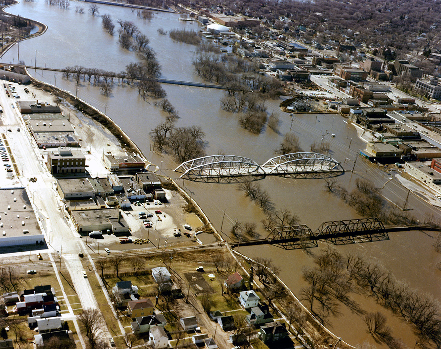 | ১,৫০০ × ১,১৮৮ (৮১২ কিলোবাইট) | smartcommons>HopsonRoad | Improve color balance. |
ফাইলের ব্যবহার
এই ফাইল ব্যবহার করে এমন কোনো পাতা নেই।
