চিত্র:IslamicConquestsIroon.png

এই প্রাকদর্শনের আকার: ২২০ × ১৯৫ পিক্সেল। অন্যান্য আকারসমূহ: ২৭০ × ২৪০ পিক্সেল | ১,০০৬ × ৮৯৩ পিক্সেল।
মূল ফাইল (১,০০৬ × ৮৯৩ পিক্সেল, ফাইলের আকার: ১০৫ কিলোবাইট, এমআইএমই ধরন: image/png)

|
This historical map image could be re-created using vector graphics as a SVG file. This has several advantages; see Commons:Media for cleanup for more information. If a SVG form of this image is available, please upload it and afterwards replace this template with
{{vector version available|new image name}}.It is recommended to name the SVG file “IslamicConquestsIroon.svg”—then the template Vector version available (or Vva) does not need the new image name parameter. |
| বিবরণIslamicConquestsIroon.png |
English: Map of the Sassanid, Byzantine and Muslim borders. |
| উৎস | File:Pre_Islamic_Arabia.PNG |
| লেখক | Javierfv1212 and edited by HistoryofIran. |
| অন্যান্য সংস্করণ |
[]
|


| Public domainPublic domainfalsefalse |

|
This file is in the public domain because File:Pre_Islamic_Arabia.PNG
|


ক্যাপশন
এই ফাইলটি কী উপস্থাপন করছে তার এক লাইন ব্যাখ্যা যোগ করুন
Map of the Sassanid and Byzantine Empires, and the Rashidun Caliphate
ফাইলের ইতিহাস
যেকোনো তারিখ/সময়ে ক্লিক করে দেখুন ফাইলটি তখন কী অবস্থায় ছিল।
| তারিখ/সময় | সংক্ষেপচিত্র | মাত্রা | ব্যবহারকারী | মন্তব্য | |
|---|---|---|---|---|---|
| বর্তমান | ১৫:৪৩, ১৮ সেপ্টেম্বর ২০১৯ | 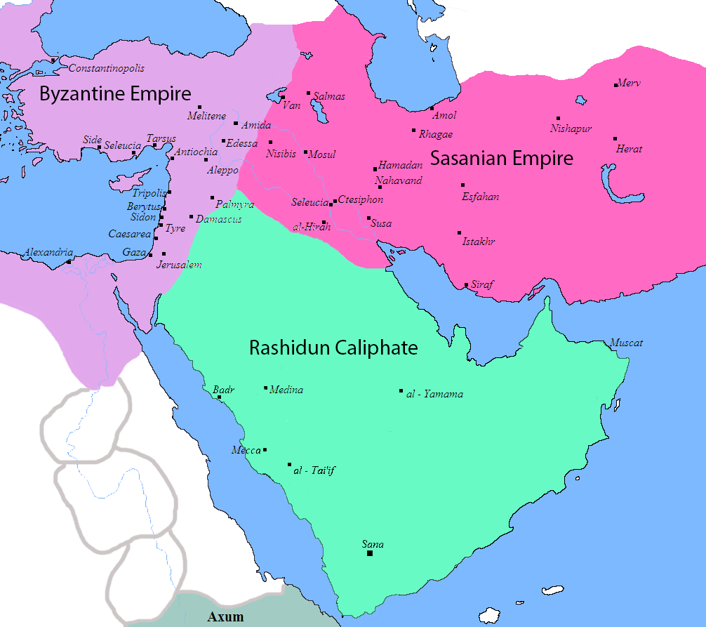 | ১,০০৬ × ৮৯৩ (১০৫ কিলোবাইট) | smartcommons>HistoryofIran | rv, thats not how it works |
ফাইলের ব্যবহার
এই ফাইল ব্যবহার করে এমন কোনো পাতা নেই।
