চিত্র:Joppen map-India in 1525 published 1907 by Longmans.jpg

এই প্রাকদর্শনের আকার: ২২০ × ৩২৩ পিক্সেল। অন্যান্য আকারসমূহ: ১৬৩ × ২৪০ পিক্সেল | ১,৮৯৩ × ২,৭৮৩ পিক্সেল।
মূল ফাইল (১,৮৯৩ × ২,৭৮৩ পিক্সেল, ফাইলের আকার: ১.৫৭ মেগাবাইট, এমআইএমই ধরন: image/jpeg)

সারাংশ
| বিবরণJoppen map-India in 1525 published 1907 by Longmans.jpg |
English: A map of India in 1525 on the eve of the Mughal conquest of Upper India, scanned from the personal copy of Historical Atlas of India by Charles Joppen SJ, Longmans, Green and Co, 1907 by Fowler&fowler (আলোচনা) 13:52, 10 July 2023 (UTC) |
| তারিখ | |
| উৎস |
Map of India 1525 showing India just before the Mughal conquest of Upper India from: Joppen, Charles [SJ.] (1907) A Historical Atlas of India for the use of High-Schools, Colleges, and Private Students, London, New York, Bombay, and Calcutta: Longman Green and Co. Pp. 16, 26 maps . |
| লেখক | Justus Perthes, Gotha./Charles Joppen Joppen, Charles [SJ.] (1907) A Historical Atlas of India for the use of High-Schools, Colleges, and Private Students, London, New York, Bombay, and Calcutta: Longman Green and Co. Pp. 16, 26 maps |
লাইসেন্স প্রদান
| Public domainPublic domainfalsefalse |

|
এই কাজটি মার্কিন যুক্তরাষ্ট্রে পাবলিক ডোমেইনে রয়েছে কারণ এটি ১ জানুয়ারি, ১৯৩১ সালের আগে প্রকাশিত (অথবা মার্কিন কপিরাইট অফিসে নিবন্ধিত) হয়েছিল।
 কমন্সে রাখার অনুমতিতে পাবলিক ডোমেইনের কাজ অবশ্যই কাজের উৎস দেশ ও মার্কিন যুক্তরাষ্ট্র উভয় দেশে কপিরাইট মুক্ত হতে হয়। যদি কাজটি যুক্তরাষ্ট্রের না হয়, তবে উৎস দেশের কপিরাইট অবস্থা নির্দেশের জন্য ফাইলে অবশ্যই একটি অতিরিক্ত কপিরাইট ট্যাগ থাকতে হবে।
PD-1923 Public domain in the United States //commons.wikimedia.org/wiki/File:Joppen_map-India_in_1525_published_1907_by_Longmans.jpg |
ক্যাপশন
এই ফাইলটি কী উপস্থাপন করছে তার এক লাইন ব্যাখ্যা যোগ করুন
A map of India in 1525 on the eve of the Mughal conquest of Upper India
ফাইলের ইতিহাস
যেকোনো তারিখ/সময়ে ক্লিক করে দেখুন ফাইলটি তখন কী অবস্থায় ছিল।
| তারিখ/সময় | সংক্ষেপচিত্র | মাত্রা | ব্যবহারকারী | মন্তব্য | |
|---|---|---|---|---|---|
| বর্তমান | ১৯:২২, ১০ জুলাই ২০২৩ | 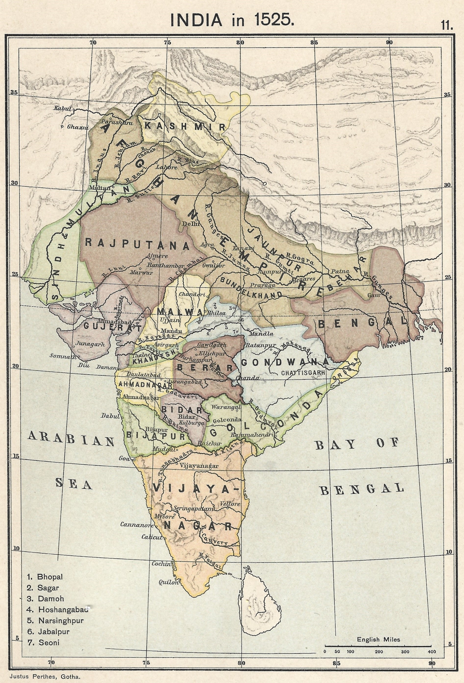 | ১,৮৯৩ × ২,৭৮৩ (১.৫৭ মেগাবাইট) | smartcommons>Fowler&fowler | Uploaded a work by Justus Perthes, Gotha./Charles Joppen {{Citation|last=Joppen|first=Charles [SJ.]|year=1907|title=A Historical Atlas of India for the use of High-Schools, Colleges, and Private Students|publisher=London, New York, Bombay, and Calcutta: Longman Green and Co. Pp. 16, 26 maps}} from Map of India 1700 showing the Mughal Empire and European trading posts/factory towns from: {{Citation|last=Joppen|first=Charles [SJ.]|year=1907|title=A Historical Atlas of India for the use of High-... |
ফাইলের ব্যবহার
এই ফাইল ব্যবহার করে এমন কোনো পাতা নেই।
