চিত্র:KangnidoMap.jpg

এই প্রাকদর্শনের আকার: ২২০ × ২০৪ পিক্সেল। অন্যান্য আকারসমূহ: ২৫৯ × ২৪০ পিক্সেল | ৬০০ × ৫৫৬ পিক্সেল।
মূল ফাইল (৬০০ × ৫৫৬ পিক্সেল, ফাইলের আকার: ৮১ কিলোবাইট, এমআইএমই ধরন: image/jpeg)
সারাংশ
| শিরোনাম |
English: Kangnido 한국어: 혼일강리역대국도지도 |
|||||||||
| বর্ণনাKangnidoMap.jpg |
English: Kangnido map (1402). The later Honkōji version of the map is available here: GeneralMapOfDistancesAndHistoricCapitals.jpg at a higher resolution. 한국어: 혼일강리역대국도지도. |
|||||||||
| তারিখ | ||||||||||
| উৎস | ... | |||||||||
| স্রষ্টা |
Kim Sahyung, Lee Moo, Lee Hui |
|||||||||
| Geotemporal data | ||||||||||
| Date depicted | ||||||||||
| ভৌগলিক সীমা |
|
|||||||||
| Warper-এ মানচিত্রের আস্তরণ | ||||||||||
| Bibliographic data | ||||||||||
| ভাষা | Hanja | |||||||||

লাইসেন্স প্রদান
|
This is a faithful photographic reproduction of a two-dimensional, public domain work of art. The work of art itself is in the public domain for the following reason:
The official position taken by the Wikimedia Foundation is that "faithful reproductions of two-dimensional public domain works of art are public domain".
This photographic reproduction is therefore also considered to be in the public domain in the United States. In other jurisdictions, re-use of this content may be restricted; see Reuse of PD-Art photographs for details. | |||||


ক্যাপশন
এই ফাইলটি কী উপস্থাপন করছে তার এক লাইন ব্যাখ্যা যোগ করুন
History of China
Geschichte Chinas
ফাইলের ইতিহাস
যেকোনো তারিখ/সময়ে ক্লিক করে দেখুন ফাইলটি তখন কী অবস্থায় ছিল।
| তারিখ/সময় | সংক্ষেপচিত্র | মাত্রা | ব্যবহারকারী | মন্তব্য | |
|---|---|---|---|---|---|
| বর্তমান | ২১:৫৯, ২২ মার্চ ২০০৫ | 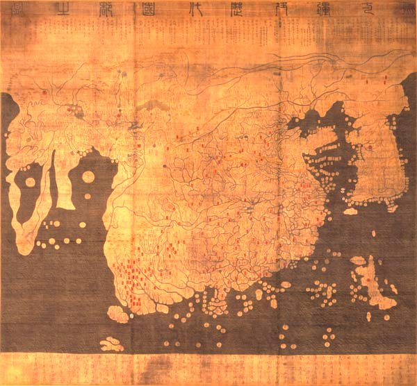 | ৬০০ × ৫৫৬ (৮১ কিলোবাইট) | smartcommons>Julgon~commonswiki | Kangnido map (1402) from en.wikipedia.org |
ফাইলের ব্যবহার
এই ফাইল ব্যবহার করে এমন কোনো পাতা নেই।
