চিত্র:Malabar 1854.jpg

এই প্রাকদর্শনের আকার: ২২০ × ২৫৮ পিক্সেল। অন্যান্য আকারসমূহ: ২০৪ × ২৪০ পিক্সেল | ৫,২৫৯ × ৬,১৭১ পিক্সেল।
মূল ফাইল (৫,২৫৯ × ৬,১৭১ পিক্সেল, ফাইলের আকার: ১৮.২৮ মেগাবাইট, এমআইএমই ধরন: image/jpeg)
সারাংশ
| বর্ণনাMalabar 1854.jpg |
Malabar region ca. 1854 |
|||||||||
| তারিখ | ||||||||||
| উৎস | An atlas of the southern part of India : including plans of all the principal towns and cantonments, reduced from the Grand trigonometrical survey of India showing also the Tenasserim Province | |||||||||
| স্রষ্টা |
J. & C. Walker; Pharoah and Co. Madras |
|||||||||
| অনুমতি (এ ফাইলের পুনঃব্যবহার) |
|
|||||||||
| Geotemporal data | ||||||||||
| ভৌগলিক সীমা |
|
|||||||||
| Warper-এ মানচিত্রের আস্তরণ | ||||||||||


ক্যাপশন
এই ফাইলটি কী উপস্থাপন করছে তার এক লাইন ব্যাখ্যা যোগ করুন
ফাইলের ইতিহাস
যেকোনো তারিখ/সময়ে ক্লিক করে দেখুন ফাইলটি তখন কী অবস্থায় ছিল।
| তারিখ/সময় | সংক্ষেপচিত্র | মাত্রা | ব্যবহারকারী | মন্তব্য | |
|---|---|---|---|---|---|
| বর্তমান | ১১:৩৬, ২৯ জানুয়ারি ২০২০ | 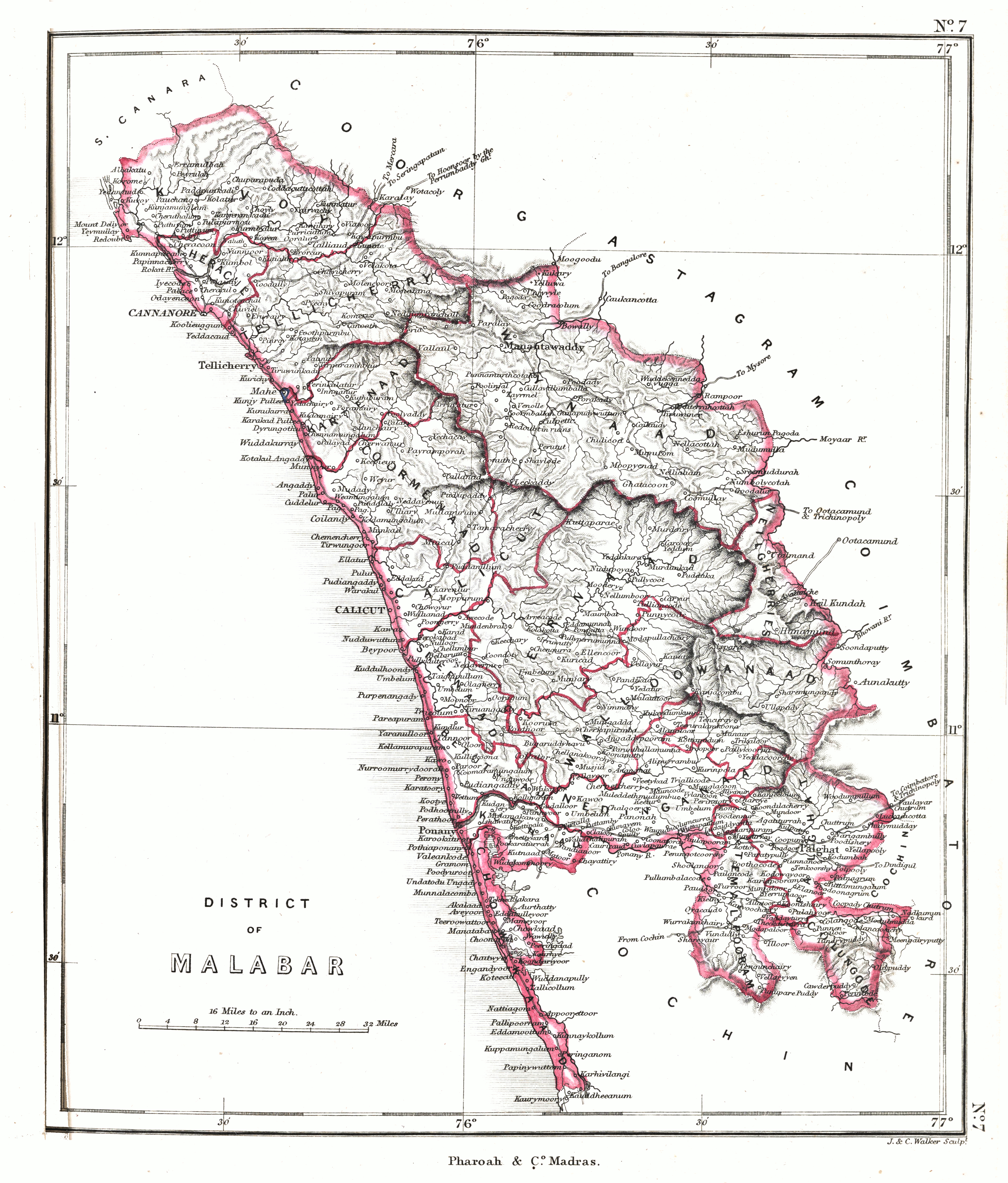 | ৫,২৫৯ × ৬,১৭১ (১৮.২৮ মেগাবাইট) | smartcommons>Shyamal | {{Map |Description=Malabar region ca. 1854 |Source=[https://searchworks.stanford.edu/view/12089476 An atlas of the southern part of India : including plans of all the principal towns and cantonments, reduced from the Grand trigonometrical survey of India showing also the Tenasserim Province] |Date=1854 |Author=J. & C. Walker; Pharoah and Co. Madras |Permission={{pd-old-70}} |other_versions= }} Category:Maps of Kerala Category:Maps of South India |
ফাইলের ব্যবহার
এই ফাইল ব্যবহার করে এমন কোনো পাতা নেই।
