চিত্র:Map of Central Asia with trade routes and movements, von Richthofen.png

এই প্রাকদর্শনের আকার: ২২০ × ১৩৩ পিক্সেল। অন্যান্য আকারসমূহ: ৩২০ × ১৯৩ পিক্সেল | ২,০৩৪ × ১,২২৭ পিক্সেল।
মূল ফাইল (২,০৩৪ × ১,২২৭ পিক্সেল, ফাইলের আকার: ৪.৮ মেগাবাইট, এমআইএমই ধরন: image/png)
সারাংশ
| বিবরণMap of Central Asia with trade routes and movements, von Richthofen.png | Map of Central Asia for overview of trade routes and movements from 128 BC to 150 AD |
| তারিখ |
Dated 1876 Published 1877 |
| উৎস |
F. von Richthofen (1877). China: Ergebnisse eigener Reisen und darauf gegründeter Studien. Band 1, Einleitender Theil [China: Expedition results and studies based thereupon. Volume 1, Introductory Part]. Berlin: Verlag von Dietrich Reimer. As reproduced in James D. Sidaway & Chih Yuan Woon (2017). Chinese Narratives on “One Belt, One Road” (一带一路) in Geopolitical and Imperial Contexts. The Professional Geographer 69(4), 591-603. doi: 10.1080/00330124.2017.1288576 |
| লেখক | F. von Richthofen (1833–1905) |
| অন্যান্য সংস্করণ |

.png)

লাইসেন্স প্রদান
| Public domainPublic domainfalsefalse |

|
এই কর্মটি এর উৎস দেশে পাবলিক ডোমেইনে রয়েছে এবং অন্যান্য দেশ ও অঞ্চলে যেখানে কপিরাটের সময়সীমা হচ্ছে লেখকের জীবন যোগ ১০০ বছর বা তাঁর কম।  You must also include a United States public domain tag to indicate why this work is in the public domain in the United States. You must also include a United States public domain tag to indicate why this work is in the public domain in the United States.
|
| এই ফাইলটি কপিরাইট আইনের আওতায় জানা সকল বাধানিষেধ মুক্ত বলে চিহ্নিত হয়েছে, যার মধ্যে সম্পর্কিত সকল স্বত্ব ও নেইবারিং সত্ত্ব সংযুক্ত। | |
https://creativecommons.org/publicdomain/mark/1.0/PDMCreative Commons Public Domain Mark 1.0falsefalse
| Annotations InfoField | This image is annotated: View the annotations at Commons |

1218
861
74
33
2034
1227
Lhasa (depicted despite not existing yet until the 8th century)
1134
889
104
33
2034
1227
Shigatse
1706
749
262
84
2034
1227
Map of Central Asia for overview of trade routes and movements from 128 BC to 150 AD
ক্যাপশন
এই ফাইলটি কী উপস্থাপন করছে তার এক লাইন ব্যাখ্যা যোগ করুন
ফাইলের ইতিহাস
যেকোনো তারিখ/সময়ে ক্লিক করে দেখুন ফাইলটি তখন কী অবস্থায় ছিল।
| তারিখ/সময় | সংক্ষেপচিত্র | মাত্রা | ব্যবহারকারী | মন্তব্য | |
|---|---|---|---|---|---|
| বর্তমান | ১৩:৪৪, ২৪ নভেম্বর ২০১৮ | 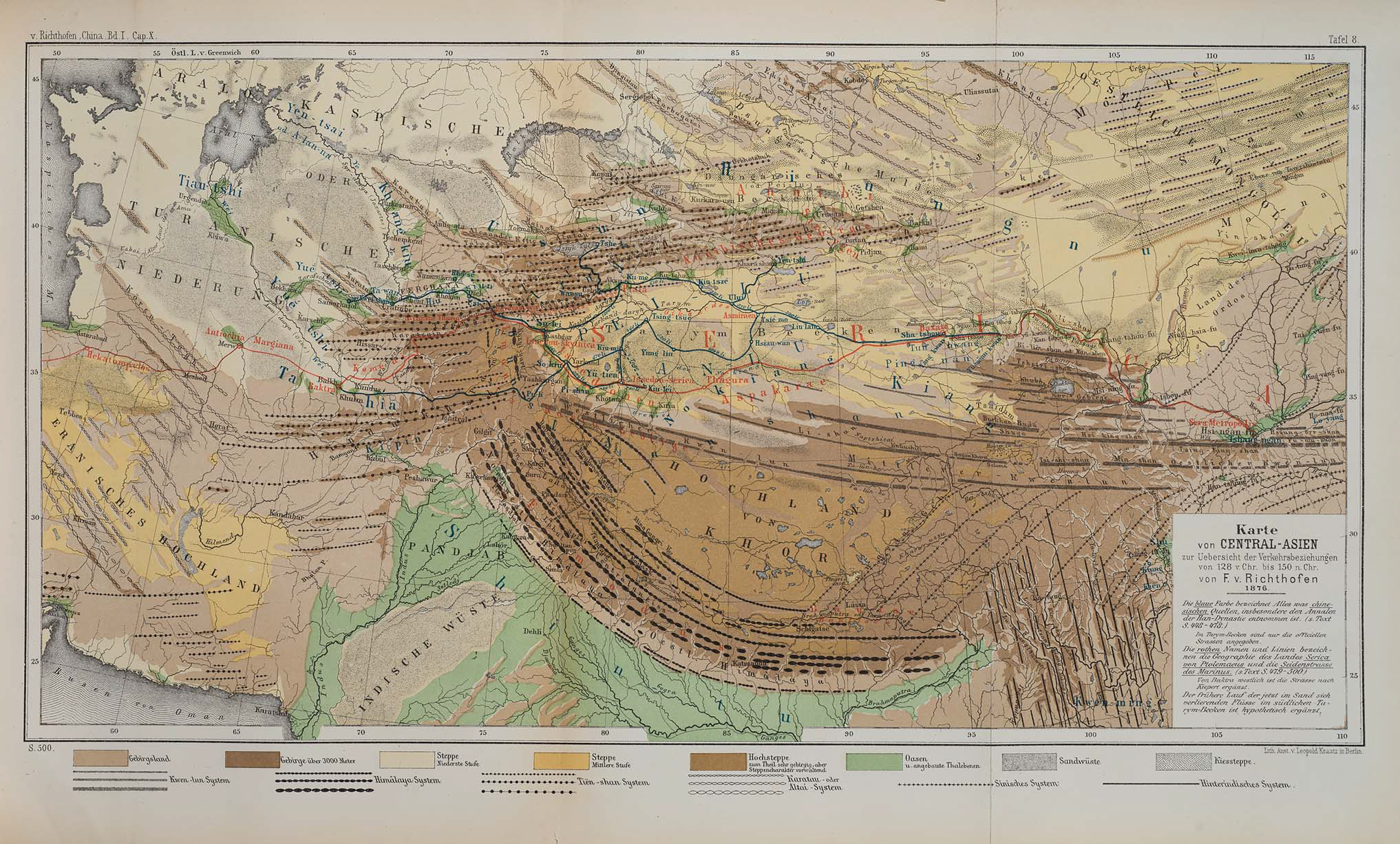 | ২,০৩৪ × ১,২২৭ (৪.৮ মেগাবাইট) | smartcommons>Cold Season | {{Information |Description= Map of Central Asia for overview of trade routes and movements. |Source= Von Richthofen, F. (1877). ''China: Ergebnisse eigener Reisen und darauf gegründeter Studien''. Band 1, Einleitender Theil [China: Expedition results and studies based thereupon. Volume 1, Introductory Part]. Berlin: Verlag von Dietrich Reimer. As reproduced in James D. Sidaway & Chih Yuan Woon (2017) Chinese Narratives on “One Belt, One Road” (一带一路) in Geopolitical and Imperial Contexts, ''T... |
ফাইলের ব্যবহার
এই ফাইল ব্যবহার করে এমন কোনো পাতা নেই।
