চিত্র:North Sentinel Island.jpg

মূল ফাইল (১,১০৪ × ১,১০৪ পিক্সেল, ফাইলের আকার: ৯৩০ কিলোবাইট, এমআইএমই ধরন: image/jpeg)

সারাংশ
| বিবরণNorth Sentinel Island.jpg |
English: On December 26, 2004, a huge earthquake offshore of Sumatra, Indonesia, unzipped a 1,600-kilometer (994-mile) stretch of the sea floor, heaved it upward as much as 5 meters (16 feet), and unleashed devastating tsunamis that scoured coastlines of countries around the Bay of Bengal and the Andaman Sea. Hundreds of thousands of people died.
From space, the most visible evidence of the event included permanent uplift of islands and coral reefs along the rupture, including remote North Sentinel Island, pictured in this photo-like image from the Advanced Land Imager on NASA’s Earth Observing-1 (EO-1) satellite from November 20, 2009. Surrounding the forested island is a perimeter of uplifted reef. Compared to their bright white color in an image acquired in February 2005 (less than two months after the quake), the exposed reefs are duller in this recent image. The darkening may be because the reefs have since been covered with mud, sand, or algae, and because the tide appears to be higher at the time of the recent image. The undisturbed appearance of the island’s forest might suggest it is uninhabited, but in fact, North Sentinel Island is home to one of the few remaining primitive tribes on Earth—hunter-gatherer tribes which have had little or no contact with modern civilization. The Indian government, which oversees the Andaman Islands territory, prohibits visitors of any kind, and the islanders themselves violently rebuff any attempts at contact. Following the 2004 tsunami, the Indian Coast Guard flew a reconnaissance mission over the island; according to news reports and photos, men emerged from the forest and loosed arrows at the helicopter, which did not attempt to land. |
| তারিখ | |
| উৎস | https://earthobservatory.nasa.gov/images/42136/north-sentinel-island-andaman-sea |
| লেখক | NASA Earth Observatory image created by Jesse Allen, using data provided by the NASA EO-1 team. |
লাইসেন্স প্রদান
| Public domainPublic domainfalsefalse |

|
এই ফাইলটি পাবলিক ডোমেইনে আছে কারণ এটি শুধুমাত্র নাসা কর্তৃক নির্মিত হয়েছিল। নাসার কপিরাইট নীতি হচ্ছে যে "নাসা কর্তৃক উল্লেখ না থাকলে নাসার উপাদান কপিরাইট দ্বারা সুরক্ষিত নয়"। (Template:PD-USGov, নাসার কপিরাইট নীতির পাতা অথবা জেপিএল চিত্র ব্যবহারের নীতি দেখুন।) |  |
 |
সতর্কবার্তা:
|
ক্যাপশন
ফাইলের ইতিহাস
যেকোনো তারিখ/সময়ে ক্লিক করে দেখুন ফাইলটি তখন কী অবস্থায় ছিল।
| তারিখ/সময় | সংক্ষেপচিত্র | মাত্রা | ব্যবহারকারী | মন্তব্য | |
|---|---|---|---|---|---|
| বর্তমান | ০১:১৯, ১১ জানুয়ারি ২০১০ | 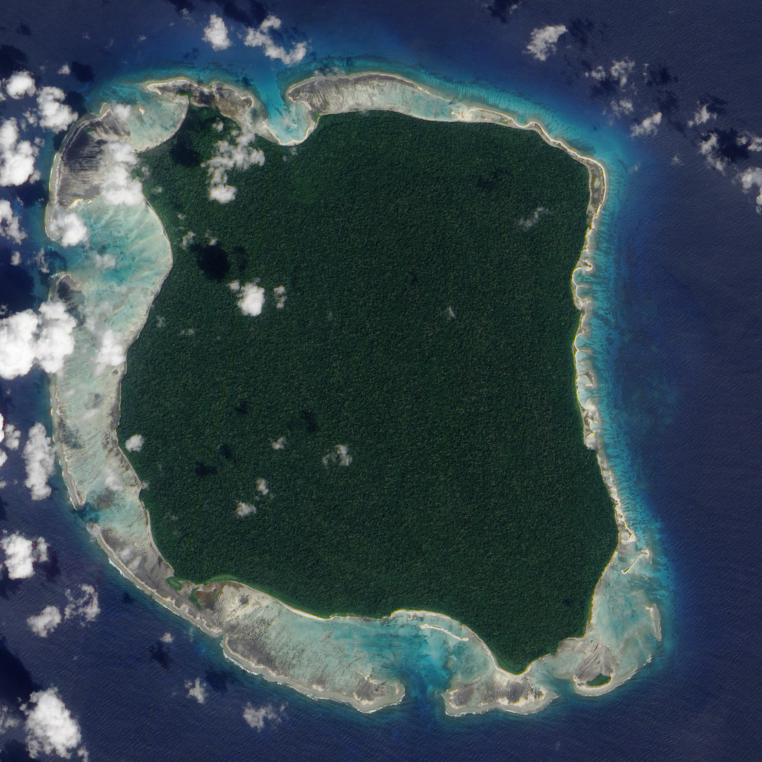 | ১,১০৪ × ১,১০৪ (৯৩০ কিলোবাইট) | smartcommons>Matthiasb | {{Information |Description={{en|1=Five years ago this past December 26, a huge earthquake offshore of Sumatra, Indonesia, unzipped a 1,600-kilometer (994-mile) stretch of the sea floor, heaved it upward as much as 5 meters (16 feet), and unleashed devasta |
ফাইলের ব্যবহার
এই ফাইল ব্যবহার করে এমন কোনো পাতা নেই।
