চিত্র:Rio de la Plata BA 2.JPG

এই প্রাকদর্শনের আকার: ২২০ × ১৪৬ পিক্সেল। অন্যান্য আকারসমূহ: ৩২০ × ২১২ পিক্সেল | ৩,০৩২ × ২,০০৮ পিক্সেল।
মূল ফাইল (৩,০৩২ × ২,০০৮ পিক্সেল, ফাইলের আকার: ১.৭৫ মেগাবাইট, এমআইএমই ধরন: image/jpeg)
সারাংশ
| বিবরণRio de la Plata BA 2.JPG |
English: NASA astronaut photograph of the Río de la Plata estuary looking west-east, the picture does not show a north and south view. Actually the right is the south and the bottom of the picture is the west. Note Greater Buenos Aires on the right side of the picture, and Montevideo on the left side (near the mouth of the Santa Lucía. To the east of Greater Buenos Aires, a smaller conurbation is visible, including La Plata (a few kilometers inland) and the Berisso-Ensenada area (near the river). Water on the river is brown because of sediments carried from the Paraná and Uruguay rivers. The color turns blue when approaching the South Atlantic Ocean. The exact location of the color change (which also implies a change from fresh to salt water) depends on winds and currents.
Español: Foto del Río de la Plata tomada desde satélite, la cámara apunta hacia el sudeste. Se aprecia la desembocadura del río Río Uruguay y del Río Paraná. En la margen derecha destaca Buenos Aires y también la ciudad de La Plata; en la izquierda, se aprecia Montevideo, próximo a la desembocadura del Río Santa Lucía. En esta zona se observa cambio de color en el agua, la cual se torna más salada según se aproxima al Océano Atlántico. |
| তারিখ | |
| উৎস | eol.jsc.nasa.gov: [1] |
| লেখক | Earth Sciences and Image Analysis Laboratory, NASA Johnson Space Center |
লাইসেন্স প্রদান
| Public domainPublic domainfalsefalse |

|
এই ফাইলটি পাবলিক ডোমেইনে আছে কারণ এটি শুধুমাত্র নাসা কর্তৃক নির্মিত হয়েছিল। নাসার কপিরাইট নীতি হচ্ছে যে "নাসা কর্তৃক উল্লেখ না থাকলে নাসার উপাদান কপিরাইট দ্বারা সুরক্ষিত নয়"। (Template:PD-USGov, নাসার কপিরাইট নীতির পাতা অথবা জেপিএল চিত্র ব্যবহারের নীতি দেখুন।) |  |
 |
সতর্কবার্তা:
|

|
This image or video was catalogued by one of the centers of the United States National Aeronautics and Space Administration (NASA) under Photo ID: ISS006-E-38952. This tag does not indicate the copyright status of the attached work. A normal copyright tag is still required. See Commons:Licensing. Other languages:
|
|


| Annotations InfoField | This image is annotated: View the annotations at Commons |

1891
1091
174
136
3032
2008
La Plata
178
386
110
80
3032
2008
Punta del Este
1573
1341
80
80
3032
2008
Colonia del Sacramento
2289
1917
91
80
3032
2008
Campana
ক্যাপশন
এই ফাইলটি কী উপস্থাপন করছে তার এক লাইন ব্যাখ্যা যোগ করুন
Río de la Plata
ফাইলের ইতিহাস
যেকোনো তারিখ/সময়ে ক্লিক করে দেখুন ফাইলটি তখন কী অবস্থায় ছিল।
| তারিখ/সময় | সংক্ষেপচিত্র | মাত্রা | ব্যবহারকারী | মন্তব্য | |
|---|---|---|---|---|---|
| বর্তমান | ১৫:৪২, ২৬ ফেব্রুয়ারি ২০১৩ | 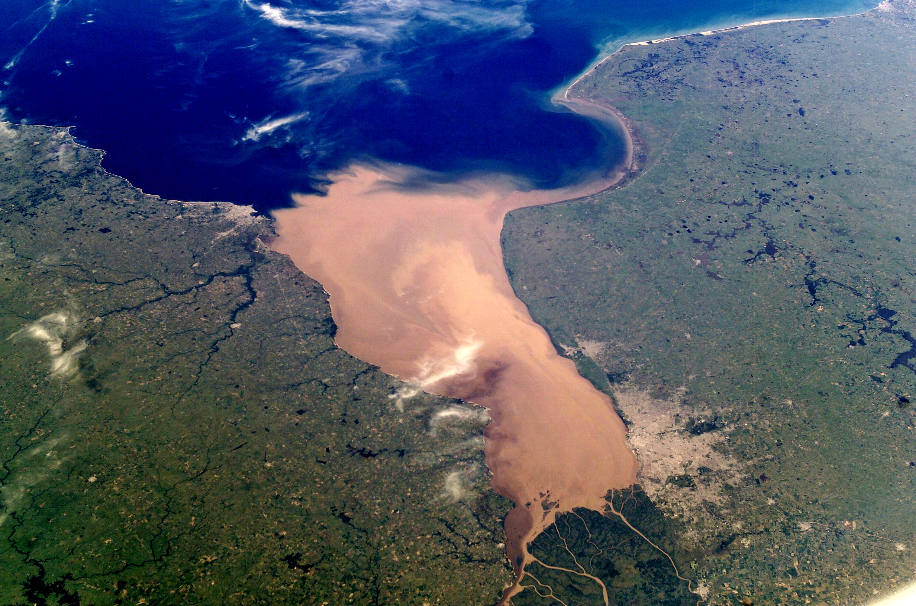 | ৩,০৩২ × ২,০০৮ (১.৭৫ মেগাবাইট) | smartcommons>Denniss | Reverted to version as of 03:52, 9 November 2011 |
ফাইলের ব্যবহার
এই ফাইল ব্যবহার করে এমন কোনো পাতা নেই।
