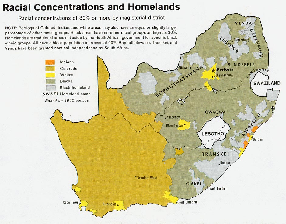
চিত্র:South Africa racial map, 1979.gif

এই প্রাকদর্শনের আকার: ২২০ × ১৭২ পিক্সেল। অন্যান্য আকারসমূহ: ৩০৭ × ২৪০ পিক্সেল | ৯৪০ × ৭৩৫ পিক্সেল।
মূল ফাইল (৯৪০ × ৭৩৫ পিক্সেল, ফাইলের আকার: ২৪৯ কিলোবাইট, এমআইএমই ধরন: image/gif)
সারাংশ

|
This ethnographic map image could be re-created using vector graphics as a SVG file. This has several advantages; see Commons:Media for cleanup for more information. If a SVG form of this image is available, please upload it and afterwards replace this template with
{{vector version available|new image name}}.It is recommended to name the SVG file “South Africa racial map, 1979.svg”—then the template Vector version available (or Vva) does not need the new image name parameter. |
| বিবরণSouth Africa racial map, 1979.gif |
Afrikaans: Rassedemografie van Suid-Afrika volgens 1970-sensusdata
English: Map showing the territorial four main races/ethnicities/colors of South Africa in 1979: Whites, Coloureds, Blacks and Indians. The gray areas indicate the Apartheid-era Bantustans, which are almost exclusively black.
This map is a photoshopped version of the CIA-made original map at Perry Castañeda map collection at the University of Texas website. |
| তারিখ | |
| উৎস |
en.wikipedia থেকে কমন্সে স্থানান্তরিত করা হয়েছে Magnus Manske কর্তৃক CommonsHelper ব্যবহার করে। (Original text : * Site: Perry-Castañeda Library Map Collection: South Africa Maps |
| লেখক | U.S. Central Intelligence Agency |
| অনুমতি (এ ফাইলের পুনঃব্যবহার) |
Public domain |
| অন্যান্য সংস্করণ |
 |



লাইসেন্স প্রদান
| Public domainPublic domainfalsefalse |

|
এই চিত্রটি সেন্ট্রাল ইন্টেলিজেন্স এজেন্সির একজন কর্মীর কর্ম, যা তিনি তার অফিশিয়াল কর্তব্যের অংশ হিসেবে সৃষ্টি করেছেন বা তুলেছেন। মার্কিন যুক্তরাষ্ট্র সরকারের একটি কর্ম হিসেবে, এই চিত্র বা মিডিয়াটি মার্কিন যুক্তরাষ্ট্রে পাবলিক ডোমেইনভুক্ত।
|

|
মূল আপলোড লগ
মূল বিবরণ পাতাটি এখানে ছিল। নিম্নলিখিত সকল ব্যবহারকারীর নাম en.wikipedia-এ উল্লেখ করা ছিল।

- 2008-08-23 06:02 MaGioZal 940×735× (254595 bytes) Map showing the territorial four main races/ethnicities/colors of South Africa in 1979: [[South African Whites|Whites]], [[Colored (South Africa)|Coloreds]], [[South African Blacks|Blacks]] and [[South African Indians|Indians]]. The gray areas indicate th
ক্যাপশন
এই ফাইলটি কী উপস্থাপন করছে তার এক লাইন ব্যাখ্যা যোগ করুন
ফাইলের ইতিহাস
যেকোনো তারিখ/সময়ে ক্লিক করে দেখুন ফাইলটি তখন কী অবস্থায় ছিল।
| তারিখ/সময় | সংক্ষেপচিত্র | মাত্রা | ব্যবহারকারী | মন্তব্য | |
|---|---|---|---|---|---|
| বর্তমান | ০২:২০, ২০ ফেব্রুয়ারি ২০১১ | 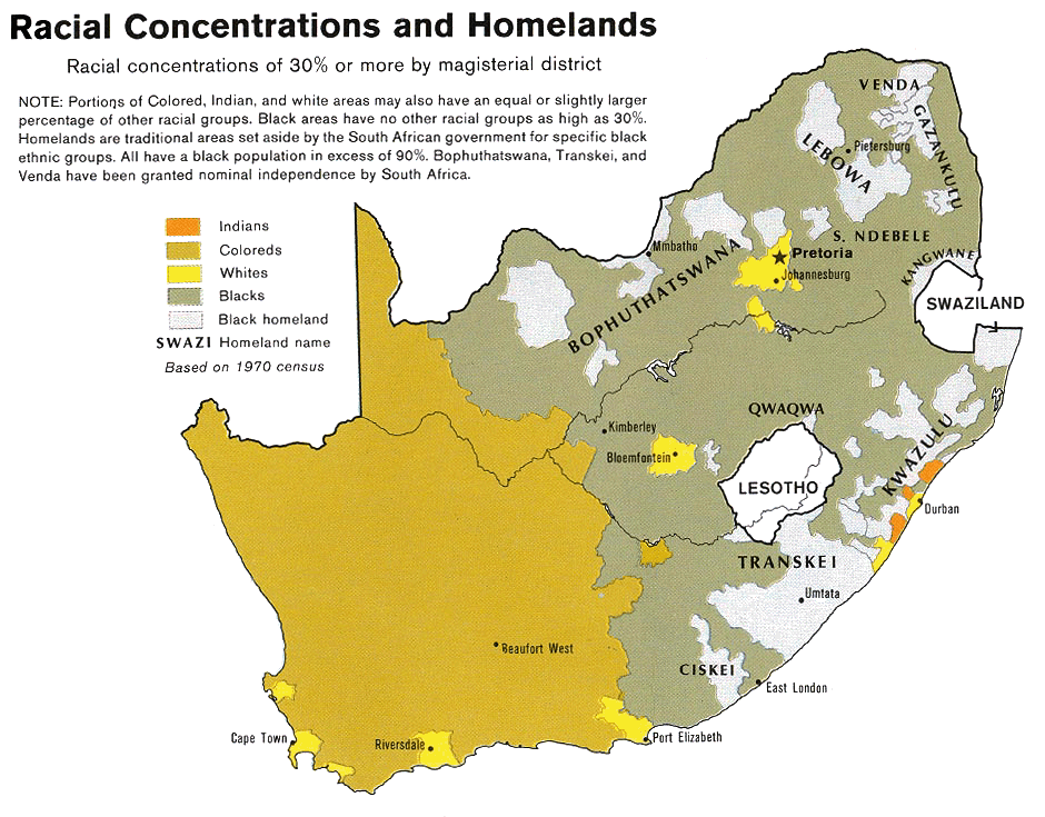 | ৯৪০ × ৭৩৫ (২৪৯ কিলোবাইট) | smartcommons>File Upload Bot (Magnus Manske) | {{BotMoveToCommons|en.wikipedia|year={{subst:CURRENTYEAR}}|month={{subst:CURRENTMONTHNAME}}|day={{subst:CURRENTDAY}}}} {{Information |Description={{en|Map showing the territorial four main races/ethnicities/colors of South Africa in 1979: [[:en:Whites in |
ফাইলের ব্যবহার
এই ফাইল ব্যবহার করে এমন কোনো পাতা নেই।
