চিত্র:The Blue Marble (remastered).jpg
.jpg)
এই প্রাকদর্শনের আকার: ২২০ × ২২০ পিক্সেল। অন্যান্য আকারসমূহ: ২৪০ × ২৪০ পিক্সেল | ৩,০০০ × ৩,০০০ পিক্সেল।
মূল ফাইল (৩,০০০ × ৩,০০০ পিক্সেল, ফাইলের আকার: ৫.৪৪ মেগাবাইট, এমআইএমই ধরন: image/jpeg)
কুমিল্লা
সারাংশ
  |
|||
|---|---|---|---|
| আলোকচিত্রশিল্পী |
NASA/Apollo 17 crew; taken by either Harrison Schmitt or Ron Evans |
 | |
| শিরোনাম |
The Blue Marble |
||
| যার অংশ | অ্যাপোলো ১৭ | ||
| বস্তুর ধরন | color photograph | ||
| বর্গ | নভোচারী আলোকচিত্রণ | ||
| বিবরণ |
Full disk view of the Earth taken on December 7, 1972, by the crew of the Apollo 17 spacecraft en route to the Moon at a distance of about 29,400 kilometres (18,300 mi). It shows Africa, Antarctica, and the Arabian Peninsula. |
||
| তারিখ |
৭ ডিসেম্বর ১৯৭২ date QS:P571,+1972-12-07T00:00:00Z/11 |
||
| মধ্যম | 1 photograph: Hasselblad 500EL, Zeiss Planar 80 mm f/2.8 and 70mm Kodak Ektachrome film of type SO-368 | ||
| সংগ্রহ |
|
||
| টীকা |
The end of most film magazines used on the Apollo missions include a photograph, presumably taken on earth, of a "KODAK Color Control Patch" on a chart containing mission and camera data. This color chart was used to calibrate the above photograph to better approximate real-world colors. Earth disk center rough coordinates: 26°19’49”S 37°25’13”E |
||
| তথ্যসূত্র | https://tothemoon.ser.asu.edu/gallery/Apollo/17/Hasselblad%20500EL%2070%20mm | ||
| উৎস | https://tothemoon.ser.asu.edu/gallery/Apollo/17/Hasselblad%20500EL%2070%20mm https://www.flickr.com/photos/projectapolloarchive/21081863984/ | ||
| অন্যান্য সংস্করণ |
[]
Derivative works:
|
||


.jpg)
.jpg)
.jpg)


.jpg)


.jpg)
.jpg¶ms=-26.330278_N_0037.420278_E_globe:Earth_class:object_type:object__&language=en)
| বস্তুর অবস্থান |  | এটি এবং অন্যান্য ছবি তাদের অবস্থানের উপর: ওপেনস্ট্রিটম্যাপ |  -26.330278; 37.420278 -26.330278; 37.420278 |
|---|
.jpg¶ms=-26.330278_N_0037.420278_E_globe:Earth_class:object_type:object__&language=bn)
লাইসেন্স প্রদান
| Public domainPublic domainfalsefalse |

|
এই ফাইলটি পাবলিক ডোমেইনে আছে কারণ এটি শুধুমাত্র নাসা কর্তৃক নির্মিত হয়েছিল। নাসার কপিরাইট নীতি হচ্ছে যে "নাসা কর্তৃক উল্লেখ না থাকলে নাসার উপাদান কপিরাইট দ্বারা সুরক্ষিত নয়"। (Template:PD-USGov, নাসার কপিরাইট নীতির পাতা অথবা জেপিএল চিত্র ব্যবহারের নীতি দেখুন।) |  |
 |
সতর্কবার্তা:
|
ক্যাপশন
এই ফাইলটি কী উপস্থাপন করছে তার এক লাইন ব্যাখ্যা যোগ করুন
Photograph of Planet Earth from space
A full disk of the Earth, centered on the sea off Mozambique, as taken by the crew of Apollo 17 on 7 December 1972, from 29,400 km (18,300 mi) above. Africa, Southwest Asia and Antarctica are shown.
כדור הארץ מהחלל
Fotografia The Blue Marble obtida durante a missão Apollo 17, em 1972
Une face complète de la Terre, centrée sur le canal du Mozambique. La photo a été prise par l'équipage d'Apollo 17, le 7 décembre 1972, à 29 400 km de hauteur. On peut y distinguer l'Afrique, l'Antarctique et la péninsule arabique.
كوكب الأرض
ফাইলের ইতিহাস
যেকোনো তারিখ/সময়ে ক্লিক করে দেখুন ফাইলটি তখন কী অবস্থায় ছিল।
| তারিখ/সময় | সংক্ষেপচিত্র | মাত্রা | ব্যবহারকারী | মন্তব্য | |
|---|---|---|---|---|---|
| বর্তমান | ০১:৪২, ৮ জুলাই ২০২৪ | 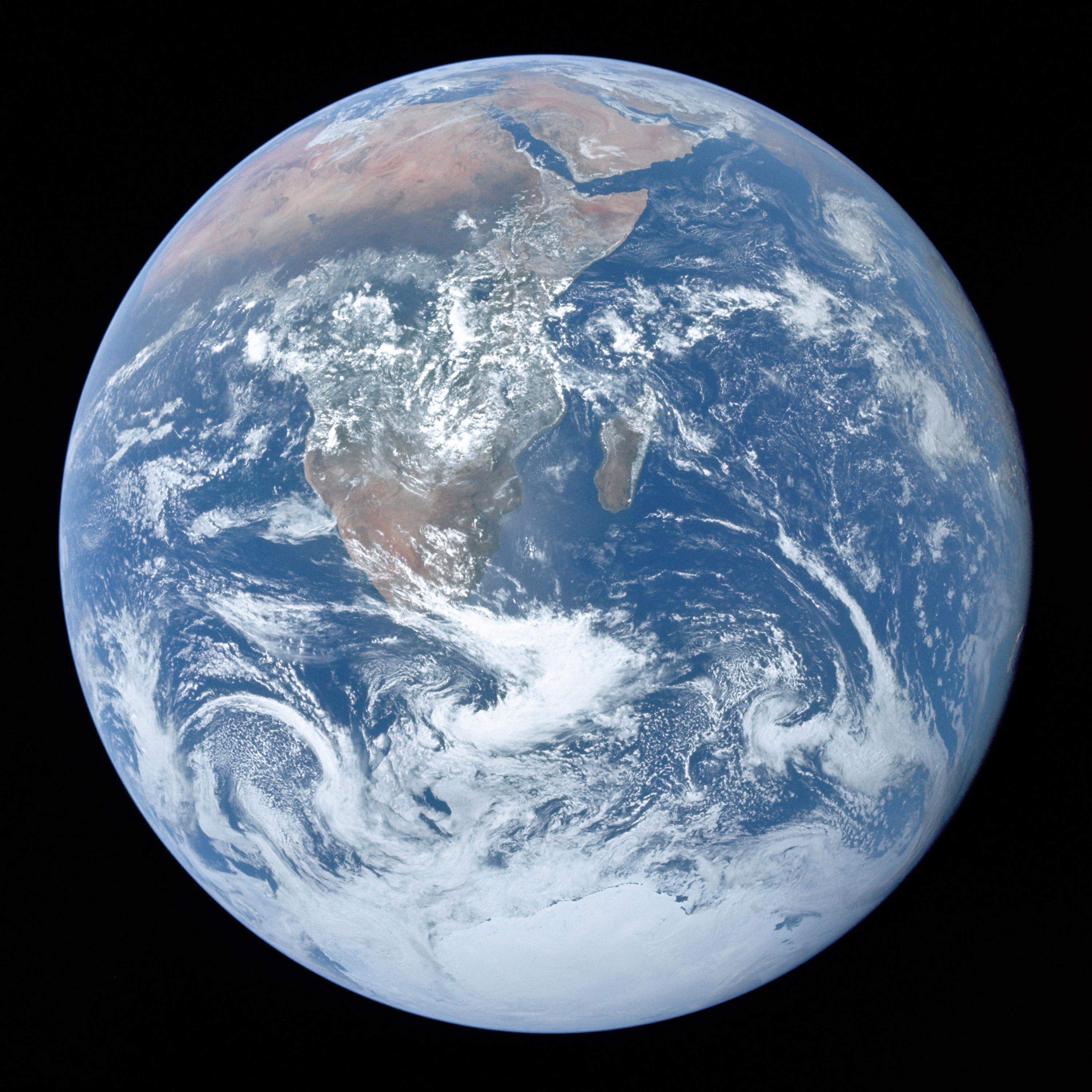 | ৩,০০০ × ৩,০০০ (৫.৪৪ মেগাবাইট) | smartcommons>Gabldotink | jpegoptim --keep-all --strip-none --all-normal |
ফাইলের ব্যবহার
এই ফাইল ব্যবহার করে এমন কোনো পাতা নেই।
.jpg)