চিত্র:Thiruparankundram rock cut cave temple inscription 1.jpg

মূল ফাইল (৩,০২৪ × ৪,০৩২ পিক্সেল, ফাইলের আকার: ২.৯৭ মেগাবাইট, এমআইএমই ধরন: image/jpeg)

সারাংশ
| বিবরণThiruparankundram rock cut cave temple inscription 1.jpg |
English: Located about 10 kilometers to the southwest of Madurai is the suburban town of Thirupparankundram (also spelled Tiruparankundram) with a massive monolithic rock. It is called Skandamalai locally.
Several Jain and Hindu rock-cut monuments and temples dating from about 1st-century BCE to 15th-century CE are found all around this rock including the famous large Tirupparamkundram Murugan Temple. This Murugan temple is a Hindu monument and is on the north face of the rock. It was expanded over the centuries from a very old Siva cave temple into a major complex. On the top of the Skandamalai rock is an Islamic monument – a 17th or 18th-century dargah built by local Muslim community to honor the last Sultan of Madurai Sultanate Sikandar Shah who along with his generals were killed in late 14th-century. On the south face of the Thiruparankundram rock is another rock-cut cave, also called Umai Andar cave or Umaiyandar temple. It has three layers of carvings. Near the cave and towards the eastern side of this rock at a higher level are Jain beds with Tamil Brahmi inscriptions. These are dated to the centuries around the start of the common era. The next layer of carvings on the outer wall in the open include Ganesha (Vinayaka) and Shaiva saints, which are from c. 8th-century (one of them has iconography that could be Jaina or Hindu). The rock-cut temple with mandapa, sanctum and inscriptions inside are dated between 8th- and 13th-century. Colonial era and several contemporary reports state that this was a Jain cave by the early centuries of the common era before being converted into a Shiva temple in the 8th-century. There is no Jain or Hindu literature, or inscriptions here that asserts this. The evidence is indirect and inferred. This hypothesis is most often inferred from the sanctum with an unusual Ardhanarishwara (half Shiva, half Parvati) relief that has a creeper-like or pepul tree leaf (Ficus religiosa) like decoration above its head. That is claimed to be the original Jain art under which was a Tirthankara image. This Tirthankara was later chiseled and changed into an Ardhanarishwara. The problem with this proposal is that the oldest monolithic rock cut shrine (stone only) found in Tamil Nadu is the Mandagapattu Temple of early 7th-century. Further, standing nude Tirthankaras have never been depicted in early or later Digambara Jain reliefs with a female breast, while the Ardhanarishwara has one that is of the natural original rock (not added with some plaster or adhesive construction material that lasts over 1,300 years). The Ardhanarishwara also has a large standing Nandi behind, which is not something found in Jain Tirthankara reliefs. Thus the Tirthankara to Ardhanarishwara suggestion remains tentative. The rock-cut temple in the surviving form is a Hindu monument. The mandapa includes two very long inscriptions, along with defaced and damaged Nataraja with Sivakami, Kalbhairava, Ganesha with a bowl of sweets, Muruga (Kartikeya, Skanda) with a peacock, and a king with two wives. Inside the sanctum is Shiva-Parvati in the form of Ardhanarishwara (half male, half female) with Nandi bull standing behind. All of the Jain and Hindu reliefs show signs of deliberate damage. This is likely to have occurred in or after the 13th-century, because one of the inscriptions reverentially praises and refers to a 13th-century Pandya ruler, who would not have allowed his name to be included before defaced and damaged reliefs. |
| তারিখ | |
| উৎস | নিজের কাজ |
| লেখক | Ms Sarah Welch |
| ক্যামেরার অবস্থান |   | এটি এবং অন্যান্য ছবি তাদের অবস্থানের উপর: ওপেনস্ট্রিটম্যাপ |  9.874703; 78.065475 9.874703; 78.065475 |
|---|

লাইসেন্স প্রদান


- আপনি স্বাধীনভাবে:
- বণ্টন করতে পারেন – এ কাজটি অনুলিপি, বিতরণ এবং প্রেরণ করতে পারেন
- পুনঃমিশ্রণ করতে পারেন – কাজটি অভিযোজন করতে পারেন
- নিম্নের শর্তাবলীর ভিত্তিতে:
- স্বীকৃতিপ্রদান – আপনাকে অবশ্যই যথাযথ স্বীকৃতি প্রদান করতে হবে, লাইসেন্সের একটি লিঙ্ক সরবরাহ করতে হবে এবং কোনো পরিবর্তন হয়েছে কিনা তা নির্দেশ করতে হবে। আপনি যেকোনো যুক্তিসঙ্গত পদ্ধতিতে এটি করতে পারেন। কিন্তু এমন ভাবে নয়, যাতে প্রকাশ পায় যে লাইসেন্সধারী আপনাকে বা আপনার এই ব্যবহারের জন্য অনুমোদন দিয়েছে।
- একইভাবে বণ্টন – আপনি যদি কাজটি পুনঃমিশ্রণ, রুপান্তর, বা এর ওপর ভিত্তি করে নতুন সৃষ্টিকর্ম তৈরি করেন, তবে আপনাকে অবশ্যই আপনার অবদান একই লাইসেন্স বা একই রকমের লাইসেন্সের আওতায় বিতরণ করতে হবে।
ক্যাপশন
ফাইলের ইতিহাস
যেকোনো তারিখ/সময়ে ক্লিক করে দেখুন ফাইলটি তখন কী অবস্থায় ছিল।
| তারিখ/সময় | সংক্ষেপচিত্র | মাত্রা | ব্যবহারকারী | মন্তব্য | |
|---|---|---|---|---|---|
| বর্তমান | ০৫:৫০, ২৭ সেপ্টেম্বর ২০১৮ | 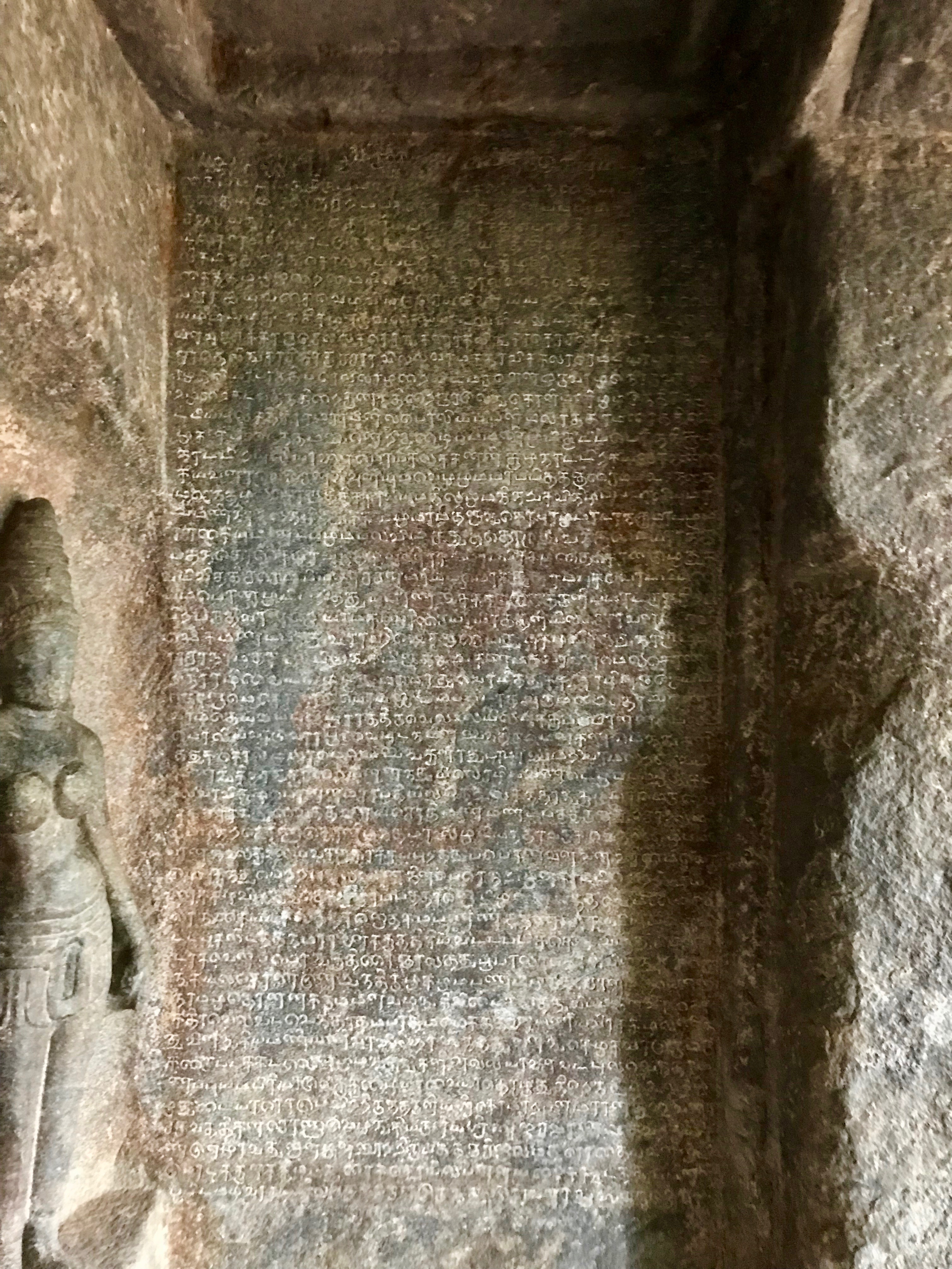 | ৩,০২৪ × ৪,০৩২ (২.৯৭ মেগাবাইট) | smartcommons>Ms Sarah Welch | User created page with UploadWizard |
ফাইলের ব্যবহার
এই ফাইল ব্যবহার করে এমন কোনো পাতা নেই।
