চিত্র:Trigonometrical Plan of the Island and Harbour of Bahrain.jpg

এই প্রাকদর্শনের আকার: ২২০ × ২৪৯ পিক্সেল। অন্যান্য আকারসমূহ: ২১২ × ২৪০ পিক্সেল | ২,০৯৮ × ২,৩৭৬ পিক্সেল।
মূল ফাইল (২,০৯৮ × ২,৩৭৬ পিক্সেল, ফাইলের আকার: ১.৮ মেগাবাইট, এমআইএমই ধরন: image/jpeg)
সারাংশ
| বিবরণTrigonometrical Plan of the Island and Harbour of Bahrain.jpg |
English: "‘Trigonometrical Plan of the Island and Harbour of Bahrein, on the Arabian Side of the Gulf of Persia; by Lieutts. G.B. Brucks, and W.E. Rogers. Hon. E.I.C. Marine Service: 1825. Drawn by Lieutt. M. Houghton; Draughtsman Hon. E.I.C. Marine. Engraved by Bateman and Son’" |
| তারিখ | |
| উৎস | Qatar Digital Library |
| লেখক | by Lieutts. G.B. Brucks, and W.E. Rogers. Hon. E.I.C. Marine Service: 1825. Drawn by Lieutt. M. Houghton; Draughtsman Hon. E.I.C. Marine |
| অন্যান্য সংস্করণ |


লাইসেন্স প্রদান
_(St_Edwards_Crown).svg)
|
This file is licensed under the Open Government Licence version 1.0 (OGL v1.0).
|
|---|---|
| স্বীকৃতিপ্রদান: 1 | |
|
You are free to:
See the Open Government Licence page on Meta-Wiki for more information. http://NationalArchives.gov.uk/doc/open-government-licence/version/1/ OGL v1.0 Open Government License version 1.0 true truehttp://NationalArchives.gov.uk/doc/open-government-licence/version/1/ OGL v1.0 Open Government License version 1.0 true true |
ক্যাপশন
এই ফাইলটি কী উপস্থাপন করছে তার এক লাইন ব্যাখ্যা যোগ করুন
Trigonometrical plan of Bahrain and Manama Harbor, 1825.
बहरीन और मनामा हार्बर का त्रिकोणमितीय योजना, 1825
ফাইলের ইতিহাস
যেকোনো তারিখ/সময়ে ক্লিক করে দেখুন ফাইলটি তখন কী অবস্থায় ছিল।
| তারিখ/সময় | সংক্ষেপচিত্র | মাত্রা | ব্যবহারকারী | মন্তব্য | |
|---|---|---|---|---|---|
| বর্তমান | ০৬:১০, ১১ জানুয়ারি ২০১৯ | 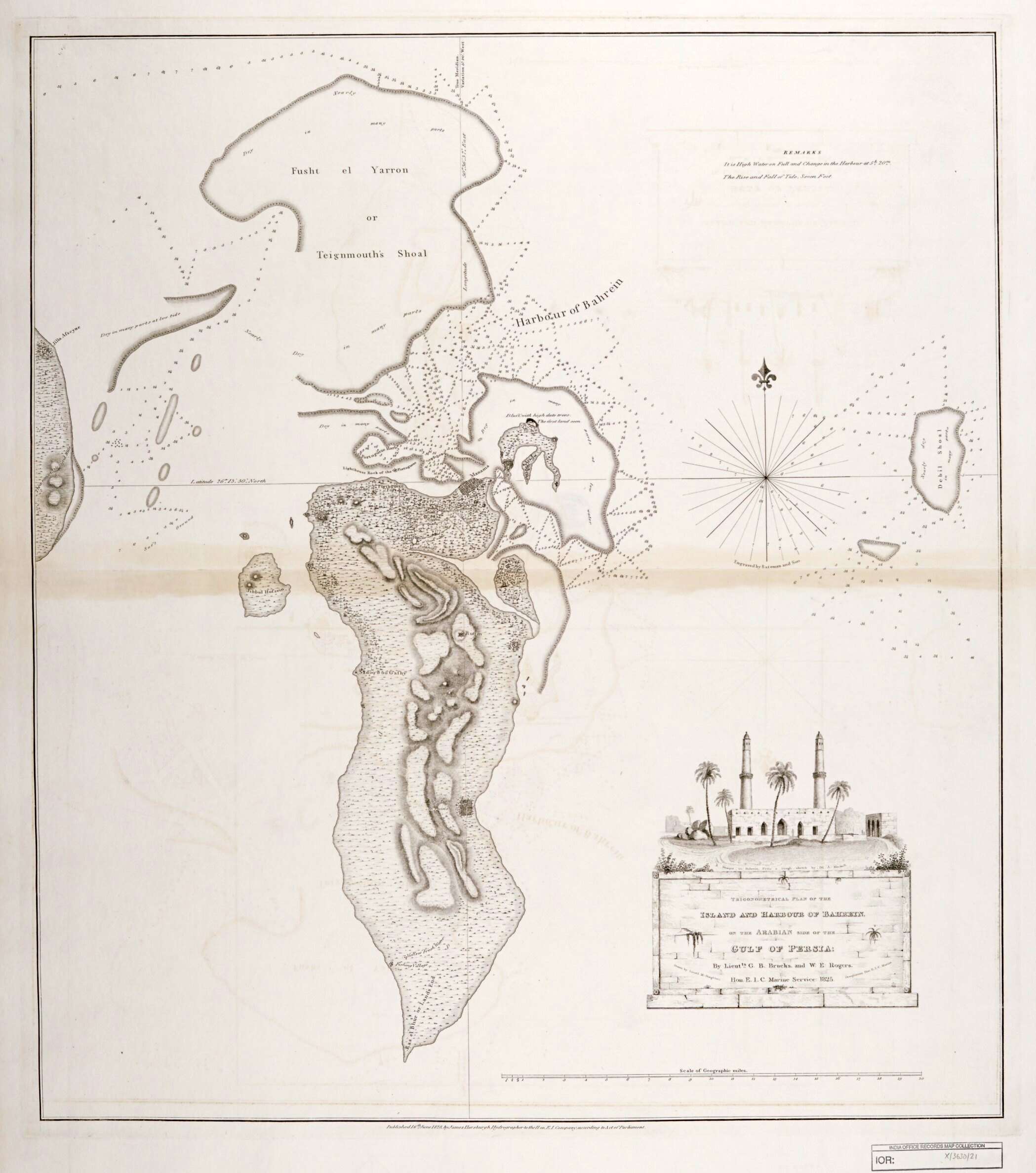 | ২,০৯৮ × ২,৩৭৬ (১.৮ মেগাবাইট) | smartcommons>Elspamo4 | Cropped, adjusted contrast |
ফাইলের ব্যবহার
এই ফাইল ব্যবহার করে এমন কোনো পাতা নেই।
