চিত্র:Yarlung Tsangpo river tibet.jpg

এই প্রাকদর্শনের আকার: ২২০ × ১৬৪ পিক্সেল। অন্যান্য আকারসমূহ: ৩২০ × ২৩৮ পিক্সেল | ১,০৭৯ × ৮০২ পিক্সেল।
মূল ফাইল (১,০৭৯ × ৮০২ পিক্সেল, ফাইলের আকার: ২২০ কিলোবাইট, এমআইএমই ধরন: image/jpeg)

সারাংশ
| বিবরণYarlung Tsangpo river tibet.jpg |
English: The mighty river featured in this image is called the Yarlung Tsangpo as it courses through the Tibetan Autonomous Region of China, and is then known as the Dikrong during its passage through India's state of Arunachal Pradesh. Further downstream, the river widens and becomes the Brahmaputra. Its waters eventually empty to the Bay of Bengal. |
| তারিখ | |
| উৎস | http://photojournal.jpl.nasa.gov/catalog/PIA03708 |
| লেখক | NASA |

|
This image or video was catalogued by Jet Propulsion Laboratory of the United States National Aeronautics and Space Administration (NASA) under Photo ID: PIA03708. This tag does not indicate the copyright status of the attached work. A normal copyright tag is still required. See Commons:Licensing. Other languages:
|
লাইসেন্স প্রদান
| Public domainPublic domainfalsefalse |

|
এই ফাইলটি পাবলিক ডোমেইনে আছে কারণ এটি শুধুমাত্র নাসা কর্তৃক নির্মিত হয়েছিল। নাসার কপিরাইট নীতি হচ্ছে যে "নাসা কর্তৃক উল্লেখ না থাকলে নাসার উপাদান কপিরাইট দ্বারা সুরক্ষিত নয়"। (Template:PD-USGov, নাসার কপিরাইট নীতির পাতা অথবা জেপিএল চিত্র ব্যবহারের নীতি দেখুন।) |  |
 |
সতর্কবার্তা:
|
ক্যাপশন
এই ফাইলটি কী উপস্থাপন করছে তার এক লাইন ব্যাখ্যা যোগ করুন
ফাইলের ইতিহাস
যেকোনো তারিখ/সময়ে ক্লিক করে দেখুন ফাইলটি তখন কী অবস্থায় ছিল।
| তারিখ/সময় | সংক্ষেপচিত্র | মাত্রা | ব্যবহারকারী | মন্তব্য | |
|---|---|---|---|---|---|
| বর্তমান | ০৫:০২, ২৩ জুন ২০০৮ | 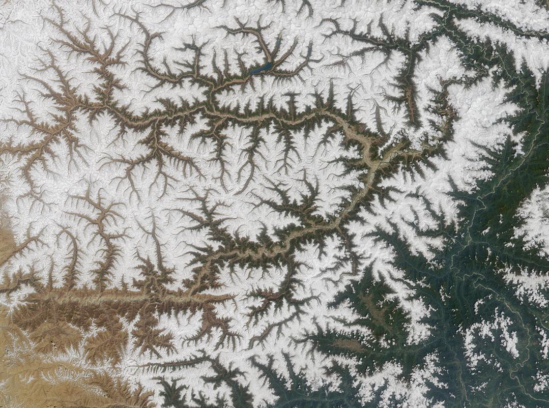 | ১,০৭৯ × ৮০২ (২২০ কিলোবাইট) | smartcommons>Denniss |
ফাইলের ব্যবহার
এই ফাইল ব্যবহার করে এমন কোনো পাতা নেই।
